Fleet Monitoring is one of the Advanced Capabilities in Safee.
In today’s competitive business landscape, efficient fleet monitoring plays a crucial role in optimizing operations and ensuring smooth logistics processes. Safee, a leading provider of state-of-the-art cloud-based asset monitoring solutions, offers a powerful platform designed to meet the unique requirements of businesses.
With a focus on highly efficient vehicle tracking capabilities and real-time data visualization, Safee empowers organizations to streamline their day-to-day operations and gain invaluable insights into their vehicle fleets.
In this blog post, we will explore the comprehensive features and tools offered by Safee platform, highlighting how they can enhance fleet management significantly.
Advanced Mapping and Fleet Monitoring
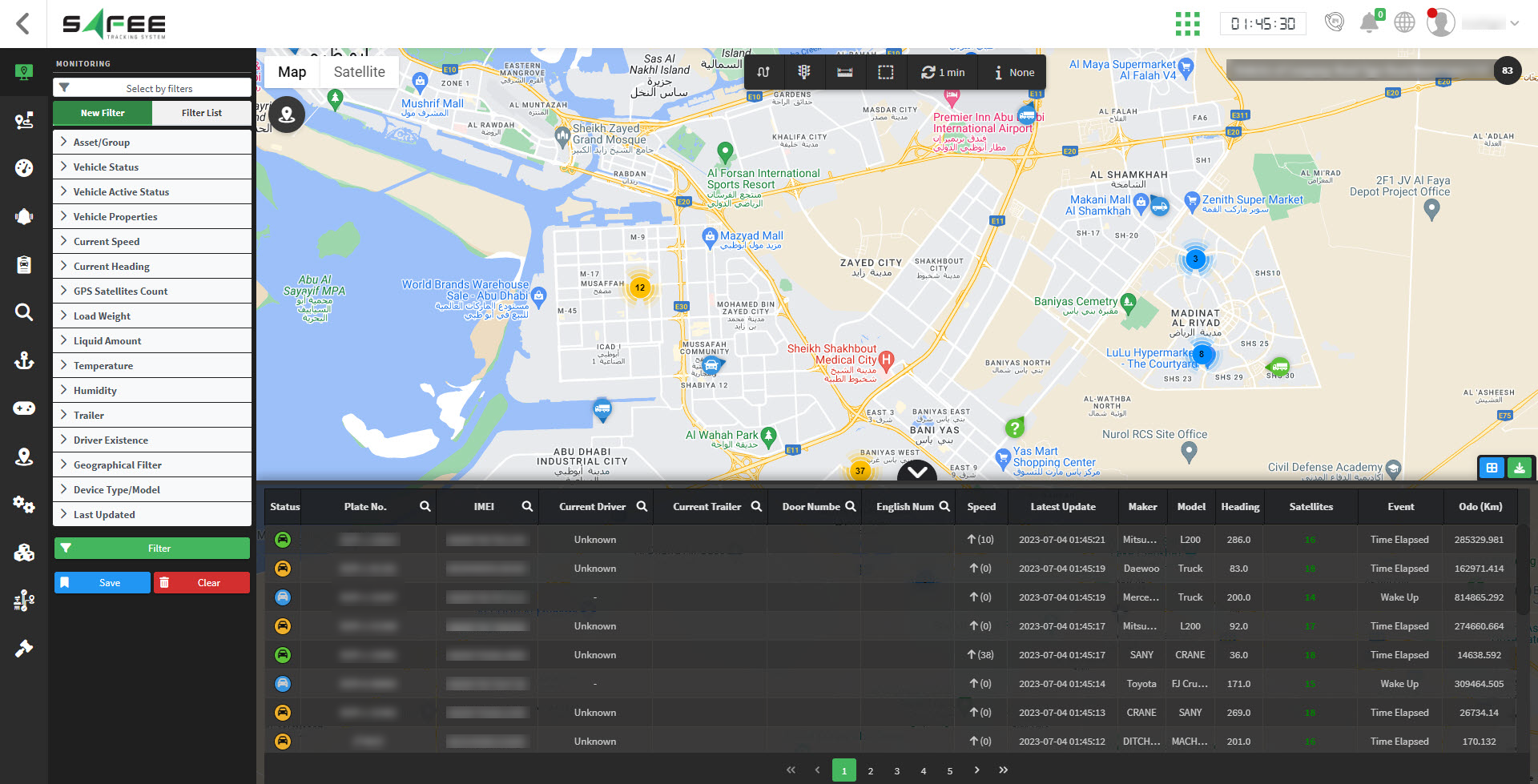
Safee’s platform integrates the powerful Google Maps API, offering businesses a wide range of meticulously optimized map views. By minimizing internet bandwidth consumption, users can visualize and track their vehicles directly on the map with ease. The user-friendly interface enables seamless navigation through the platform, allowing businesses to locate and monitor their vehicles effortlessly. Safee’s intuitive hierarchical tree structure further enhances productivity by enabling the export of vehicles to dedicated tabs, maximizing operational efficiency and focused monitoring.
Enhanced Fleet Monitoring with Powerful Tools
Safee’s monitoring page provides various tools to enhance the user experience and streamline fleet management. Let’s explore some of these tools:
-
Geofences Tools:
Easily search and view geofences and routes on the map, eliminating the need for a separate geofences page.
-
Show/Hide Vehicles Path:
Customize output by displaying vehicle paths for the past 5 minutes on the map, focusing on specific areas and opening them in new browser windows.
-
Measurement Tools:
Accurately measure distances between two points on the map, providing valuable information for planning and analysis.
-
Export Tools:
Simplify data management by exporting vehicles within a marked area to a separate screen, facilitating focused monitoring and analysis.
-
Refresh Timer:
Define the update time for the web application, balancing timely updates and system performance.
Key Information at Your Fingertips in Fleet Monitoring
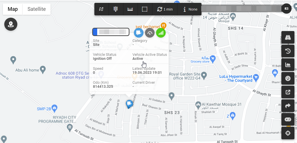
When selecting a vehicle on the monitoring page, you’ll have access to various options displaying key information:
-
Vehicle Card:
This card includes main details such as vehicle status, speed, GPS status, … etc. and allows customization of sixteen additional vehicle information. The card has two sides, each presenting eight pieces of information that can be toggled.
-
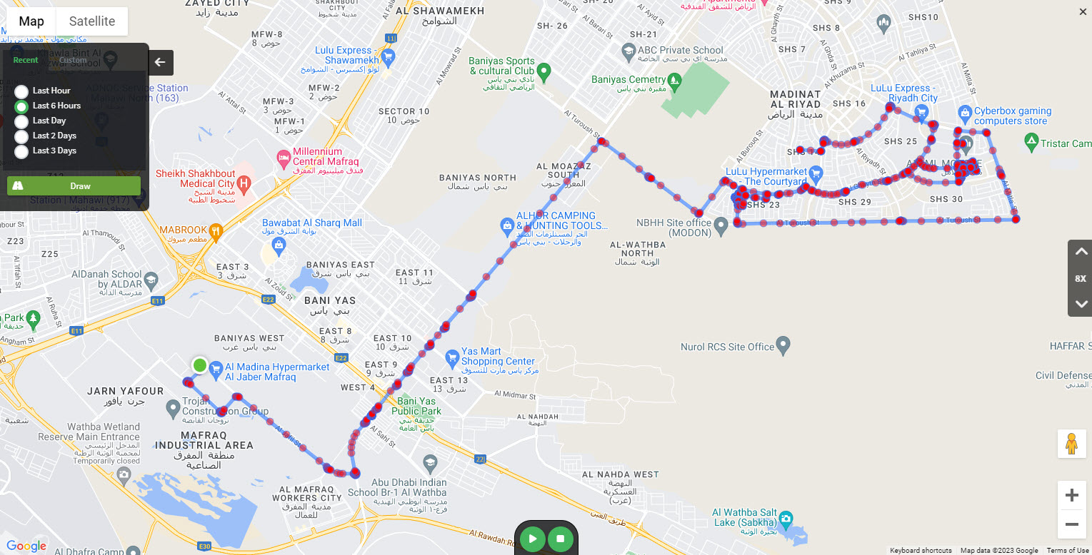
Explore Vehicle Path:
To get quick snapshots of the recent vehicle’s activities and routes history via a pre-defined set of time filters and via custom start and end dates/times entries. Playback of the vehicle trip history is available too with several play-speed options.
-
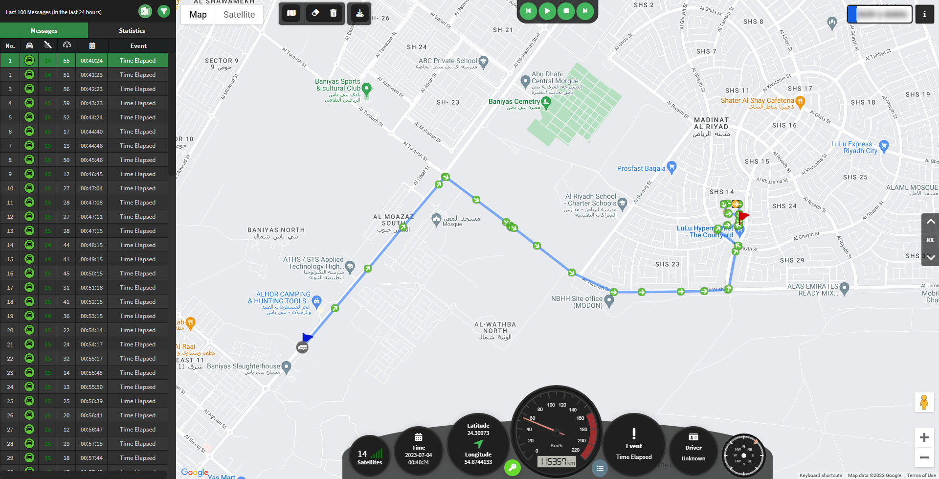
Explore History:
Provides advanced route history with comprehensive details of events, alarms, speed, violations, and geofences. The Explore History feature gives you in-depth information for thorough analysis and a better understanding of the vehicle’s actual recent activities.
-
Vehicle Timeline:
Easily accessed from the monitoring page by clicking the timeline icon, this feature provides a chronological overview of the vehicle’s status, communication, and speed changes over time, displaying all triggered alarms and events with complete data exporting options.
-
Vehicle Dashboard:
Users gain access -for each vehicle of the fleet- to a comprehensive dashboard full of analytical widgets displaying critical information and stats about that vehicle’s engine performance, rpm, speed, GPS communication status, fuel consumption, idling, alarms, and events charts, and geofence visits stats.
Efficient Fleet Monitoring with Custom Filters
To streamline monitoring tasks, the Safee platform provides a wide range of filtering options. Administrators can categorize vehicles into different categories within specific sites, enabling complete control over fleet management. Users can filter vehicles based on categorization, asset/group, vehicle status, active status, properties, speed, heading, GPS satellite count, load weight, liquid amount, temperature, humidity, trailer connectivity, driver existence, geographical filter, and last update time. This level of customization ensures optimal oversight and control over vehicle operations, even when dealing with large fleets.
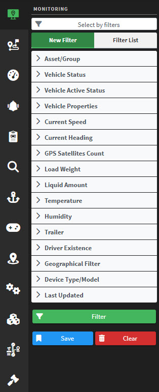
Configurable Filters for Personalized Fleet Monitoring:
Safee’s platform allows users to configure custom filters based on their specific needs, aligning with their business requirements. Once defined, users can save these filters for future use, making them an integral part of their user profile. This feature provides quick access to personalized saved filters, enhancing monitoring readiness and efficiency.
Enhanced Collaboration with Sharable Links
The Sharable Link feature enables users to share vehicle information and map views with others effortlessly.
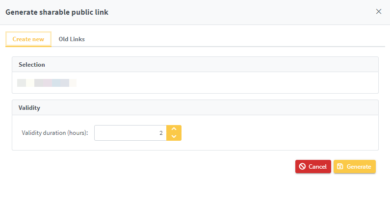
Users can generate unique links with specified validity periods, allowing controlled access to shared information. Multiple sharable links can be created simultaneously, enabling flexible sharing of vehicle information or map views with various recipients. In Safee monitoring, sharable public links can be generated for multiple aspects and cover several options such as a link for a single vehicle, a cluster of multiple selected vehicles on a map, a link for the result of applying a saved filter, and that option specifically open the door to the users to go granular as they need in their fleet management experience.
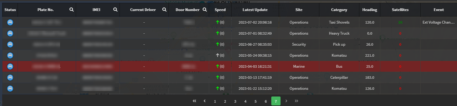
Streamlined Communication and data interpretation
The messaging table introduces the fleet information in the basic tabular form that users can interpret easily and quickly. The table is located at the bottom of the monitoring page and offers users a range of filtering, and customization options. It provides up-to-date details and search capabilities based on vehicle plate number, IMEI, current driver, trailer, door number, … etc.

Users can personalize the table by adding or removing specific columns of vehicle details, and key information such as vehicle status, distance daily limit, speed limit, event descriptions, GPS satellite count, heading direction, vehicle category and site, last update time, IMEI number, plate number. Right-clicking on any vehicle in the table shows plenty of useful options that can be applied to that vehicle like a centered view of that vehicle on the map, viewing the vehicle’s location on Google Maps, and even sending commands too.

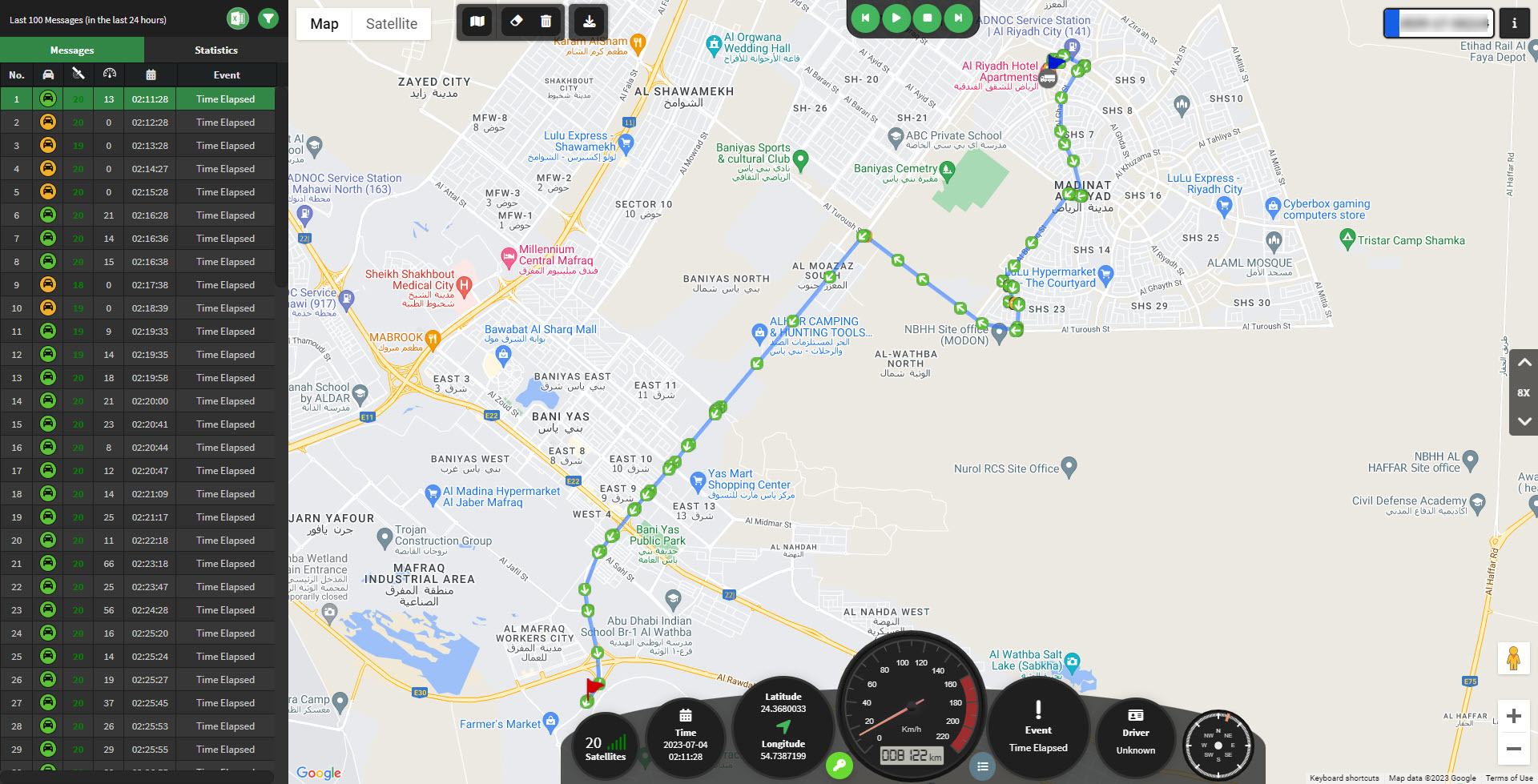
The Vehicle History feature
It provides a comprehensive overview of the vehicle’s past activities and events. With an array of powerful functionalities, it allows fleet managers to gain valuable insights, analyze historical data, and make informed decisions. Here are some key components of the vehicle history feature:
-
Playback:
that enables users to visually replay the historical movement of the vehicle on the map. This playback function allows you to track the vehicle’s route, speed, and other relevant information at a specific period. It provides a dynamic and interactive visualization of the vehicle’s past movements, facilitating a better understanding of its behavior and patterns.
-
Filtering:
advanced filtering options that allow you to refine your search for specific events or periods. You can filter by date and time range, specific vehicle or driver, geofences, and other parameters. This flexibility enables you to focus on the data that is most relevant to your analysis and decision-making process.
-
Export:
Safee’s Vehicle History allows you to export historical data for further analysis or reporting purposes. You can export the data in various formats, such as CSV or Excel, making it compatible with different tools and workflows. This export functionality enhances your ability to perform in-depth analysis, share insights with stakeholders, and integrate the data into your existing systems.
-
Reverse Geocoding:
Safee incorporates the latest technological trends in reverse geocoding capabilities, and provides its users with the exact needed tools that convert the geographic coordinates of a vehicle’s location into human-readable addresses instantly and accurately. This feature provides contextual information about the vehicle’s whereabouts, making it easier to interpret and analyze historical data.
-
Statistics:
Statistical insights into a vehicle’s past performance and behavior. You can access information such as average speed, maximum speed, distance traveled, idle time, and more. These statistics help you identify trends, anomalies, and areas for improvement, supporting data-driven decision-making and proactive fleet management.
-
Geofences:
Integrated geofencing functionality, allowing you to define and monitor virtual boundaries on the map. By overlaying geofences onto the historical data, you can analyze how vehicles interacted with specific areas of interest. This feature is useful for tracking entry and exit times, measuring time spent within geo-fenced zones, and identifying patterns or deviations from predefined routes.
-
Bad Order Messages:
This feature is all about making sure that messages in the alarms table are in the right order. Sometimes, messages can get delivered in the wrong sequence, which can cause problems. To help with this, when a message arrives in the wrong order, it will be highlighted in red to let us know that something’s not right. The main goal of this feature is to make sure that any data from these out-of-order messages doesn’t mess up our analysis or any other processes. It worth to mention that there is an easy-to-use filter for this issue. This filter enables users to easily isolate and exclude the out-of-sequence messages from the alarms table to make sure that the data we rely on is accurate and reliable.
- Widgets: Diverse widgets that display key metrics and parameters at a glance. You can monitor a variety of widgets such as speed, driver, RPM, fuel consumption, idling, and more. These widgets provide real-time information and enable you to monitor specific aspects of the vehicle’s history without the need for extensive data exploration.
Heatmaps for huge fleets analytical studies
Safee’s heatmap provides fleet managers with a powerful tool that is designed specifically to enhance the fleet behavior analysis and for better trends finding and identification. By aggregating GPS tracker and telematics data, the Heatmap provides a visual representation of vehicle locations on a map, enabling users to make informed decisions and optimize routing. Key features of Safee’s heatmap include geofence integration, customizable filters, dynamic date range editing, and more.
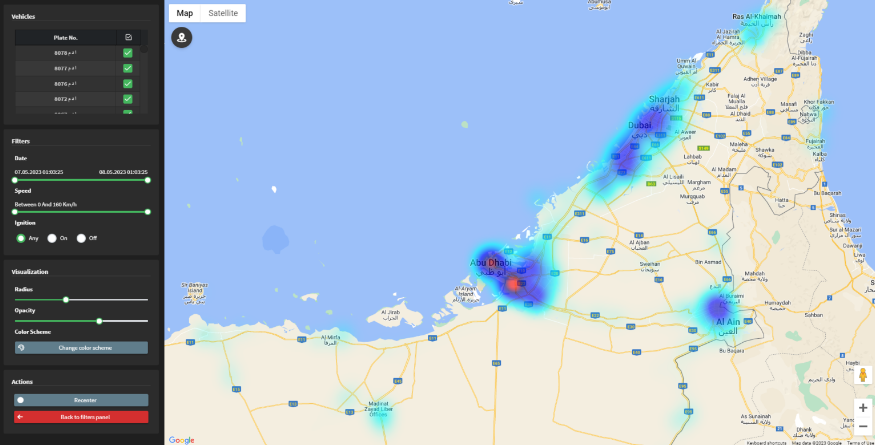
Overlaying geofences on the heatmap allows users to validate vehicle movements against user-defined boundaries, ensuring compliance with designated areas and routing rules. The ability to fine-tune the heatmap data by specifying speed ranges and ignition status provides deeper insights into vehicles’ activity. And with customizable data point dimensions, transparency, and color schemes, users can easily interpret and analyze fleet density based on their preferences, so they can spotlight the fleet’s behavioral trends and currently covered areas for better help in future planning and business operations expanding management to serve new potential areas across the whole country and beyond.
Past Location Report, Unlocking Valuable Insights into Vehicles Activity
The past location report provides fleet managers with the latest known location of a selected vehicle or group of vehicles within a specified timeframe, in this report, the user can see the last location of the vehicle from the chosen date until the period that is specified in the inputs. By generating this report, users gain valuable insights into past vehicles’ locations, enabling them to analyze historical patterns and make informed business decisions.
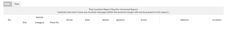
Generating the report is simple: users choose the desired level (site/category/vehicle) and specify the start date and duration. The report is presented in two forms, a tabular form and on a map.
Geofence Backtracking Reporting
This is another amazing tool introduced by Safee to empower fleet managers to track and analyze the vehicles’ and drivers’ historical movements and trips within previously existing and newly created geofences during any selected timeframe.
This report shows all the vehicles and drivers who passed by the selected geofences during a specific date range, so the user can check geofence-vehicle transitions, vehicles and drivers’ visits to geofences, and elapsed time and distance in geofences.
The report is generated according to the historical trips saved in the system. The system will check the vehicles/drivers’ trips and check all passed selected geofences during each trip. For each pass, the report shows: enter date and time, leave date and time, distance, duration, and enter and leave locations on the map.
Users can apply all kinds of grouping, aggregations, sorting, filtering, and exporting on the report’s results.
Locating and Analyzing Trips On a Map
Safee’s Trips module offers a convenient way to locate and analyze specific trips of interest. By utilizing various filtering options, users can easily find and classify trips based on specific criteria. The Map component within the Trips module allows users to dynamically display filtered trips (single trip or multiple) on a map, providing a clear and interactive view of their spatial distribution.

This visual analysis tool enables users to explore trips in their geographical context, uncovering patterns, correlations, and insights. Additionally, the Map component displays associated geofences, further enhancing the understanding of trips and their relationship to specific geographic areas.
Join to Safee platform now and start benefiting from the amazing
suite of monitoring features designed to streamline fleet management, improve operational efficiency, enhance your workforce productivity and overall business profitability.
Arabic : هذا المنشور متوفر أيضاً باللغة